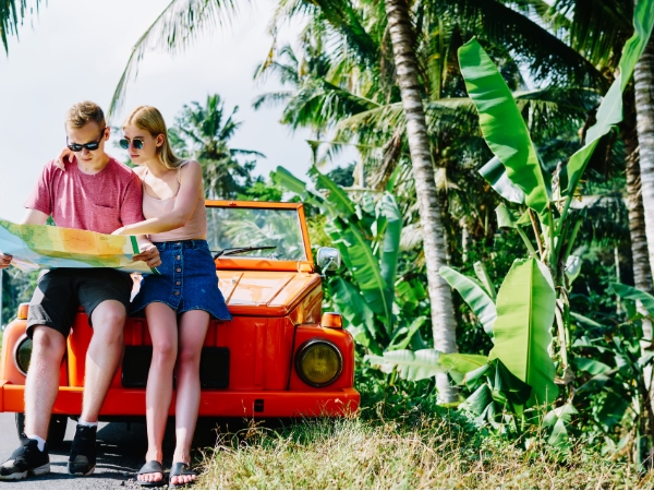
Trinidad's Northern Range is a chain of forested mountains that forms a striking backbone across the island’s north. To truly experience the region, you should rent a car. Driving gives you control over your schedule, lets you stop at scenic viewpoints, and helps you reach remote spots that are difficult to see.
A road trip through the Northern Range combines natural beauty, historic sites, and cultural traditions. You will find waterfalls, birdwatching retreats, turtle nesting beaches, and villages with deep heritage. Our Northern Trinidad travel guide will show you the best places to visit in Northern Range, how to make the drive safe and enjoyable, and what activities to enjoy.
The Northern Range is the most prominent mountain system in Trinidad. It stretches across the island's north, forming a rugged green barrier between the Caribbean coast and the rest of the country. This range is geologically linked to Venezuela’s Paria Peninsula. Its terrain is steep and dissected by deep valleys, with altitudes rising to 940 metres. The combination of forests, rivers, and waterfalls makes this one of the best places to visit in Northern Range.
The Northern Range begins at the Chaguaramas Peninsula in the west and runs to Toco in the east. Its peaks dominate the skyline, with El Cerro del Aripo and El Tucuche. Meanwhile, the average height of the ridge is about 600 metres. Thirteen major valleys cut into its southern slopes, some filled with residential areas and others used for farming. The eastern end of the range receives the highest rainfall in Trinidad, which feeds waterfalls, rivers, and some of the lushest forests on the island.
The Northern Range is home to over 100 species of mammals, reptiles, and amphibians, making it one of the richest ecological zones in the Caribbean. Among its birdlife, two endemic species stand out: the Trinidad motmot and the Trinidad piping guan. Both are treasured sightings for birdwatchers. The forests comprise hardwood trees such as teak, mahogany, crabwood, kapok, and hog plum. Beneath these giants, the understorey is thick with lianas, bromeliads, orchids, and ferns. The wildlife here feels more like South America than the Caribbean islands, with species like monkeys and ocelots moving through the dense greenery.
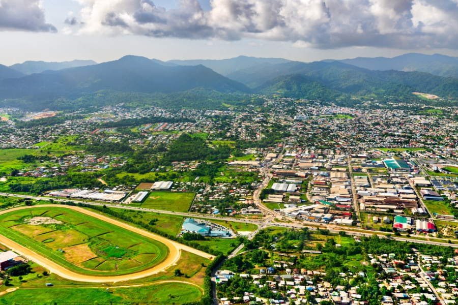
When you start your road trip, the capital city of Port of Spain is the natural point of departure. It is a 3-hour drive from Robinson International Airport with a distance of 174 kilometres. From here, the roads lead eastward along the busy stretch known as the East–West Corridor, which sits immediately south of the Northern Range.
The East–West Corridor is a large city in the north of Trinidad. It comprises many communities so close together that it is often hard to see where one ends and another begins. The Eastern Main Road, the Priority Bus Route, and the Churchill Roosevelt Highway are three main roads that run through the area.
If you drive north from Port of Spain, you'll soon see the Santa Cruz Valley. The Saddle Road is a beautiful road that goes through narrow gorges and rolling hills before passing through rich farmland. The valley is famous for its cocoa groves, flower gardens, and old-fashioned wooden gingerbread houses. The route is lined with tall samaan trees and bamboo groves, which give it a lush, pastoral feel.
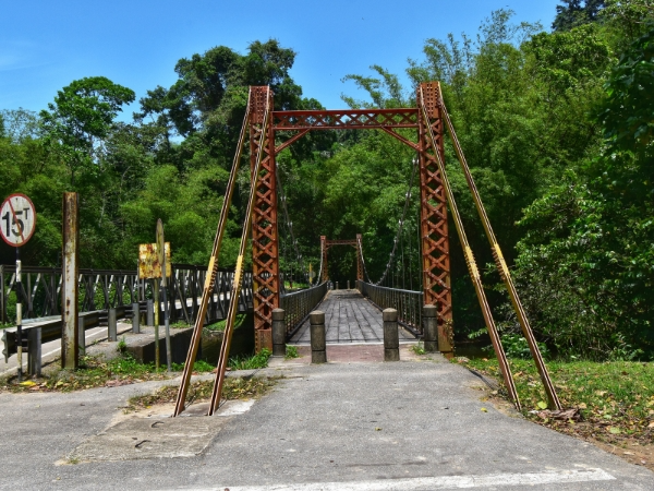
As you continue eastward, the road climbs into the true heart of the Northern Range. This is where your journey changes from city traffic to misty forests, mountain peaks, and rural communities. The roads here are narrow, winding, and sometimes rough, but they lead you to some of the most rewarding parts of your road trip to Blanchisseuse.
One of the most famous roads through the Northern Range is the Arima–Blanchisseuse Road. It cuts through dense forest, climbing high peaks cooled by mountain breezes before descending again toward the coast. The surface is often potholed, and drainage works may damage sections. Still, the journey rewards you with some of the most beautiful mountain scenery in the Caribbean.
Along this road, you will find Brasso Seco village, one of the best bases for hiking in Trinidad. The community is located under the peak of El Cerro del Aripo and offers trails to several waterfalls and river pools. Brasso Seco is known for its mixed Amerindian, Spanish, and African heritage, and its annual festival features parang music, local food, and dancing. Further along, you reach the Asa Wright Nature Centre, an internationally recognised retreat for birdwatchers.
Another scenic route branching off the Eastern Main Road is the Heights of Guanapo Road. Unlike the Arima–Blanchisseuse Road, this is less travelled and far more rugged. It follows the Guanapo River for a few kilometres before turning into a rough lane often used by logging trucks. A four-wheel drive is highly recommended if you plan to travel here. The road eventually leads into quiet forest areas where hiking trails begin. The highlights of this region are the Guanapo Gorge and nearby waterfalls such as La Laja and Sombasson. The gorge has sheer rock walls and clear waters cutting through the forest.
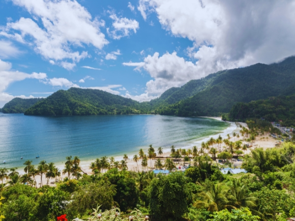
After driving through the mountains, the road eventually meets the sea again. The North Coast Road is one of the most dramatic drives in Trinidad, hugging cliffs as high as 300 metres while revealing sudden views of the Caribbean Sea below. You will encounter fishing villages, fruit stalls, and scenic viewpoints along this route. For travellers wanting to visit northern Trinidad, this road offers some of the island's best beaches and coastal communities.
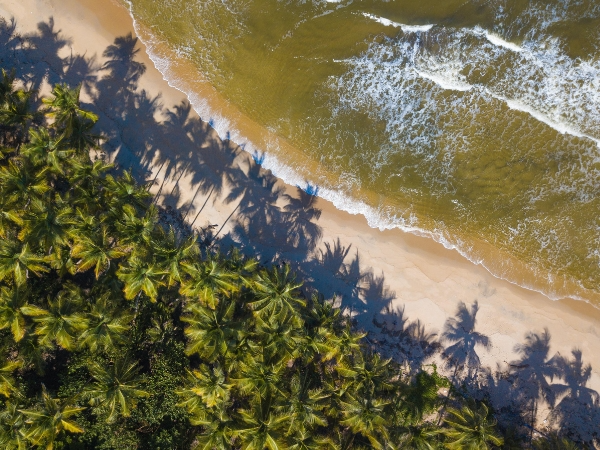
Maracas Bay, Trinidad’s most famous beach, is the first major stop along the coast. It is a 50-minute drive from Port of Spain. The beach is a long curve of off-white sand backed by tall palm trees and mountain slopes. Waves here can be strong, reaching one or two metres, but lifeguards are on duty and mark safe swimming areas with flags.
Continuing eastward, you will reach Las Cuevas, the longest beach on the north coast. Its name comes from the caves in the rocks at the bay's western end. The beach is wide and quiet, with calm emerald-green waters safer for swimming than Maracas. Las Cuevas is surrounded by coconut palms and enclosed by headlands that protect it from strong winds. Facilities here include parking, showers, toilets, and lifeguards. The main drawback is the presence of sandflies, especially in the late afternoon or after rain, so repellent is necessary.
The last major village on the coastal road is Blanchisseuse. The beaches here are rugged and often have strong currents, especially between October and February when surfers arrive to enjoy the waves. However, Blanchisseuse is also a starting point for hikes to some of Trinidad's most beautiful natural spots. The walk to Paria Bay and Falls is among the most rewarding, combining rainforest trails with a stunning beach and waterfall. Closer to the village, you can enjoy river swimming at Three Pools or visit Avocat Falls on the Arima–Blanchisseuse Road.
Beyond Blanchisseuse, the paved road ends and gives way to old donkey trails known locally as the Bench Trail. These tracks once connected cocoa estates along the coast and are now used by hikers. The trail runs to Matelot, a remote village about 30 kilometres to the east. The trail is rich in wildlife and offers stunning views as it dips in and out of the forest and coastline. It is also a key nesting area for leatherback turtles from March to August.
The further you travel along the Northern Range, the more remote and untouched the coastline becomes. This is where you encounter fishing villages, turtle nesting beaches, and rugged cliffs. It takes several hours to reach this part of the island, but it is one of the best places to visit in Northern Range if you want to see rural life and unspoiled nature.
The village of Matura lies on the Toco Main Road and is best known for its long, windswept beach. The waters here are rough, and the currents are powerful, so it is not recommended for casual swimming. What makes Matura special is its importance as a turtle nesting site. From March to August, endangered leatherback turtles haul themselves out of the ocean to lay eggs in the sand.
Further along the coast, you reach Grande Riviere, one of the world's most important leatherback turtle nesting sites. At the season's peak, as many as 500 turtles can arrive on the beach in a single night. The setting is spectacular, with a wide sandy bay framed by jungle-covered hills and a clear river flowing into the sea. Like Matura, Grande Riviere requires permits and guides for turtle-watching. Even outside of turtle season, Grande Riviere is worth visiting. The river is excellent for freshwater swimming, and the surrounding forest is home to the rare Trinidad piping guan, also called the pawi. This bird has disappeared from most of the island but is relatively common here.
Toco is a fishing village with strong cultural roots at the far northeast tip of Trinidad. It has a place in modern sporting history, as it is the hometown of Olympic javelin champion Keshorn Walcott. The atmosphere here is traditional, with old gingerbread houses, rum shops, and a quiet way of life. A little further west lies Matelot, one of the most remote villages in Trinidad. The village is small, with farming and fishing as the main activities. From here, the Bench Trail links back to Blanchisseuse, though most travellers experience only short sections.
A road trip through the Northern Range is not only about beaches and villages. The mountains are among the most spectacular parts of northern Trinidad. The range is perfect for hiking and exploration, with peaks rising close to 1,000 metres. The rivers and streams flowing from these slopes feed reservoirs and plunge into waterfalls.
The highest point in Trinidad is El Cerro del Aripo, 940 metres above sea level. It is part of the Aripo Massif, located northeast of Arima. Climbing this mountain brings cooler temperatures and dense forest, where rare plants and animals can still be found.
Close in height is El Tucuche, the second-highest mountain in Trinidad at 936 metres. The mountain is covered with misty forests, and hikers who reach its summit are rewarded with sweeping views. Walking here is not easy, as the trail includes steep climbs and narrow paths bordered by cliffs. Along the way, you pass through different types of forest, including a cloud forest with epiphyte-covered trees. You may hear or see red howler monkeys in the distance if you are lucky.
The Maracas Valley Waterfall crashes down 90 metres into a pool where you can swim. The path to reach it is straightforward, passing groves of tall balata trees, and along the way, you may see signs of the area’s spiritual use, such as candles left by worshippers. Other waterfalls worth visiting include Avocat Falls near Blanchisseuse and Marianne Falls nearby, each set in lush forest and offering natural pools for swimming. One of the most important rivers is the Quare River, which has been dammed to create the Hollis Reservoir, a primary source of water for the island.
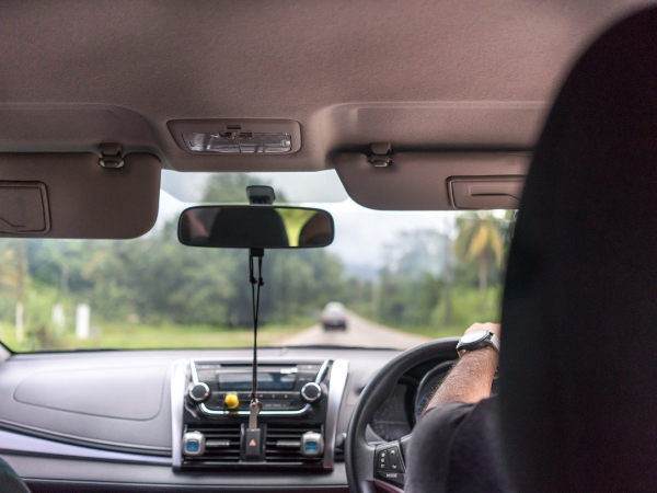
A road trip through the Northern Range is exciting, but you must plan carefully. The roads here are different from the highways near Port of Spain. They are often narrow, winding, and cut into steep slopes, so driving requires focus and patience. The climate also changes quickly, with sudden rain showers that can make roads slippery.
The dry season from December to April is the best time for exploring the Northern Range. You will find stable weather, cooler air, and easier hiking conditions during these months. Waterfalls still flow, but rivers are less likely to flood, making trails safer. If you want to see wildlife, especially leatherback turtles, then March to August is the key period. This is when turtles come ashore at Matura and Grande Riviere.
Driving in the Northern Range differs greatly from driving in the flat central plains. The Arima–Blanchisseuse Road and the North Coast Road have sharp bends, steep climbs, and occasional potholes. Landslides are also a risk during the rainy season, so you must drive slowly and be alert. In some areas, such as the Heights of Guanapo Road, a four-wheel drive vehicle is strongly recommended due to rough terrain. Take your time, avoid overtaking on blind corners, and always follow the instructions of road signs and local drivers.
A road trip through the Northern Range brings together high mountains, green valleys, hidden waterfalls, turtle-nesting beaches, and historic villages. To fully enjoy this adventure, rent a car in Trinidad with Final Rentals. Begin your journey by picking up your vehicle at Robinson International Airport or Port of Scarborough. From compact city cars to spacious SUVs, Final Rentals offers well-maintained vehicles to suit your trip. Booking is instant and transparent, with no hidden fees and free cancellations. For extra convenience, you can also download the Final Rentals app on Google Play and the App Store.